Icons for Smuggler’s Notch
ORW / Smuggler's Notch
Sign Program and Visitor Map at Smuggler’s Notch Scenic Highway
Project Description
In addition to visitor shelters, information kiosks, gateway signs, and historic site interpretive displays, ORW’s conceptual plan for Smuggler’s Notch Scenic Highway called for a tourist map. Charles Gibson Design was asked to develop the graphic standards of the map and the wayfinding signage.
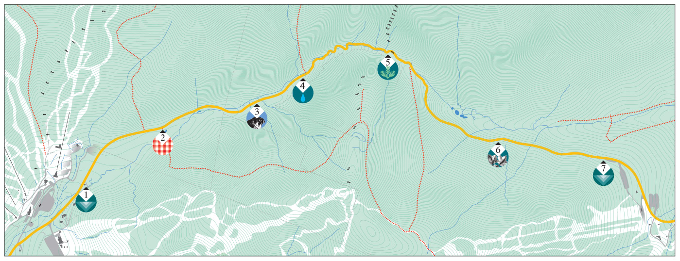
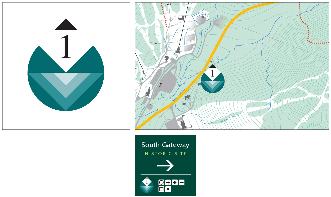
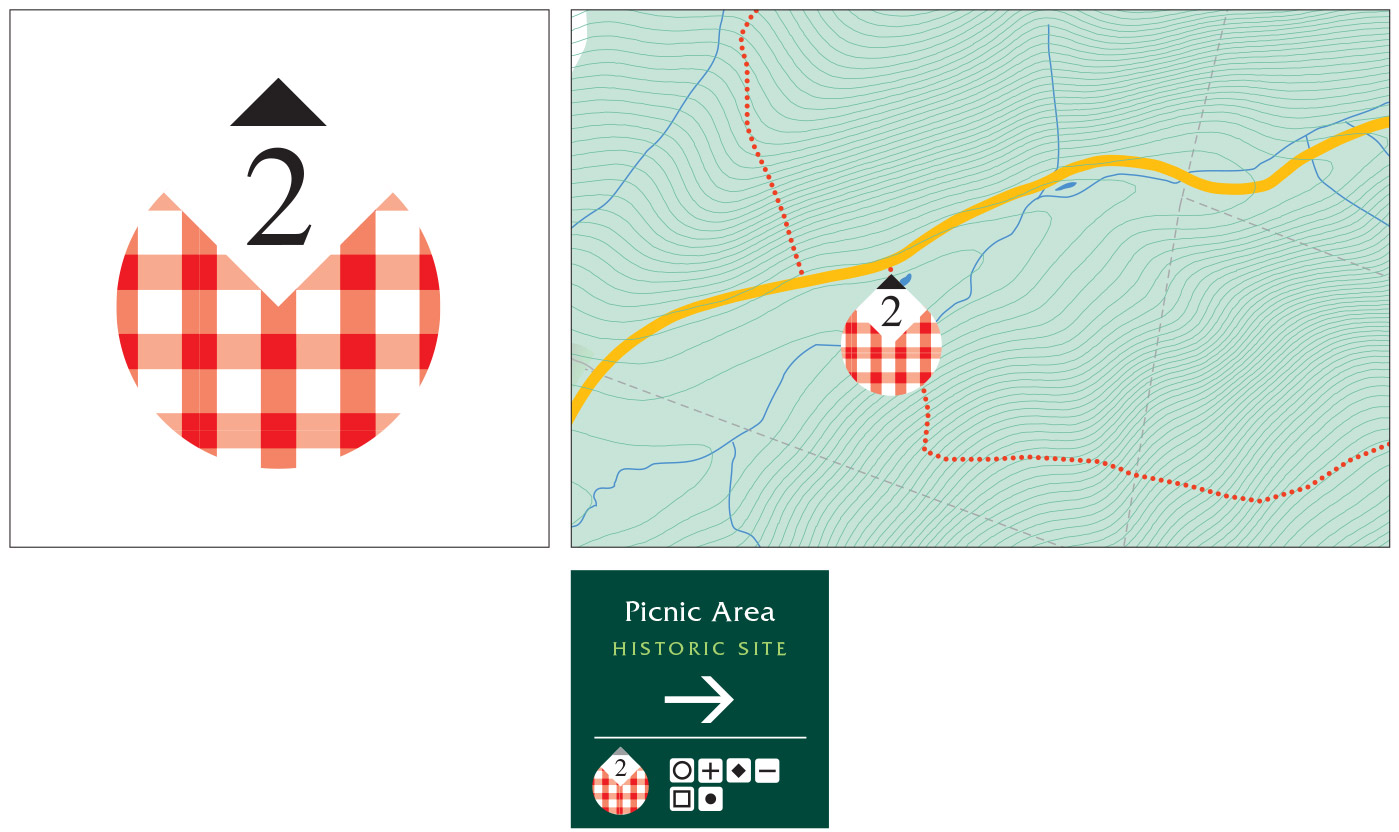
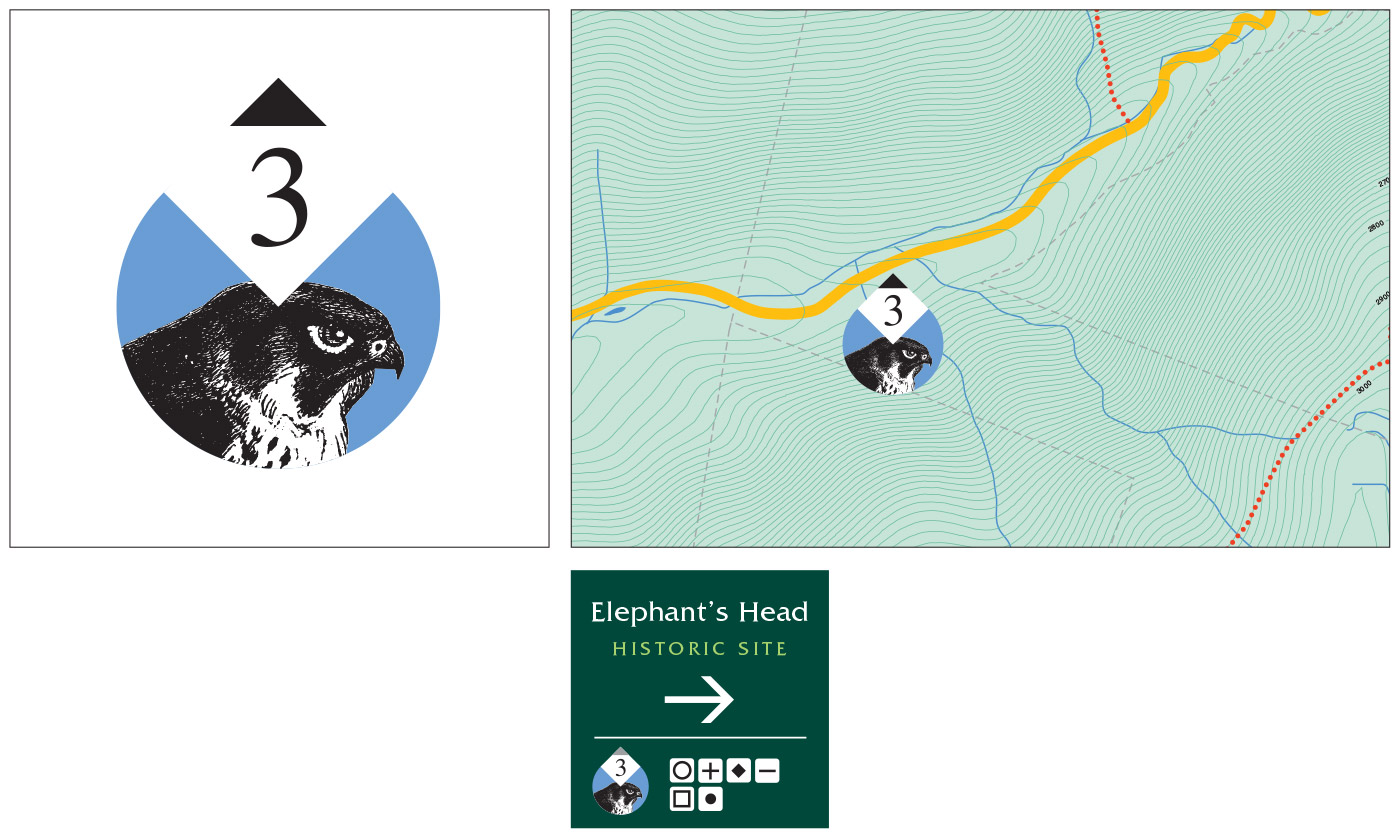
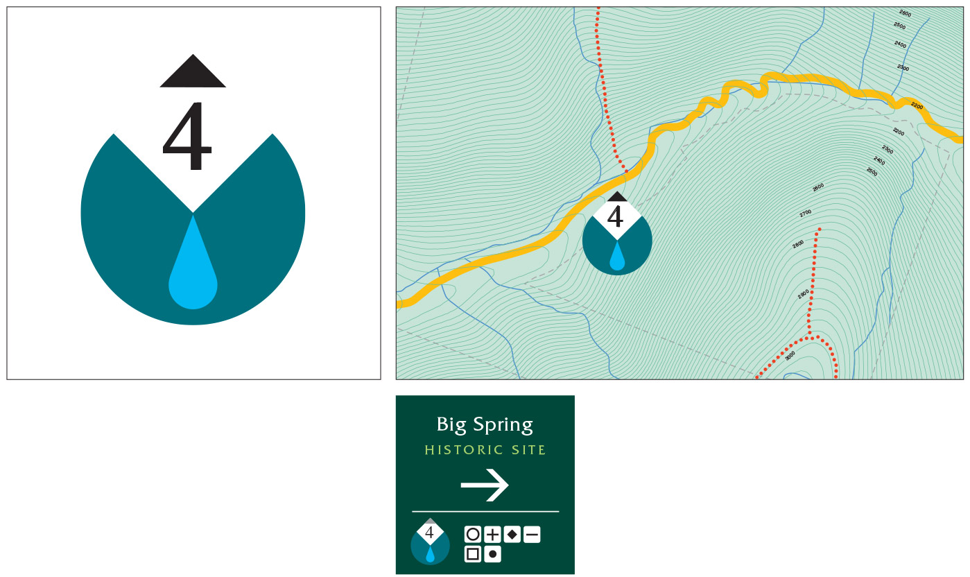
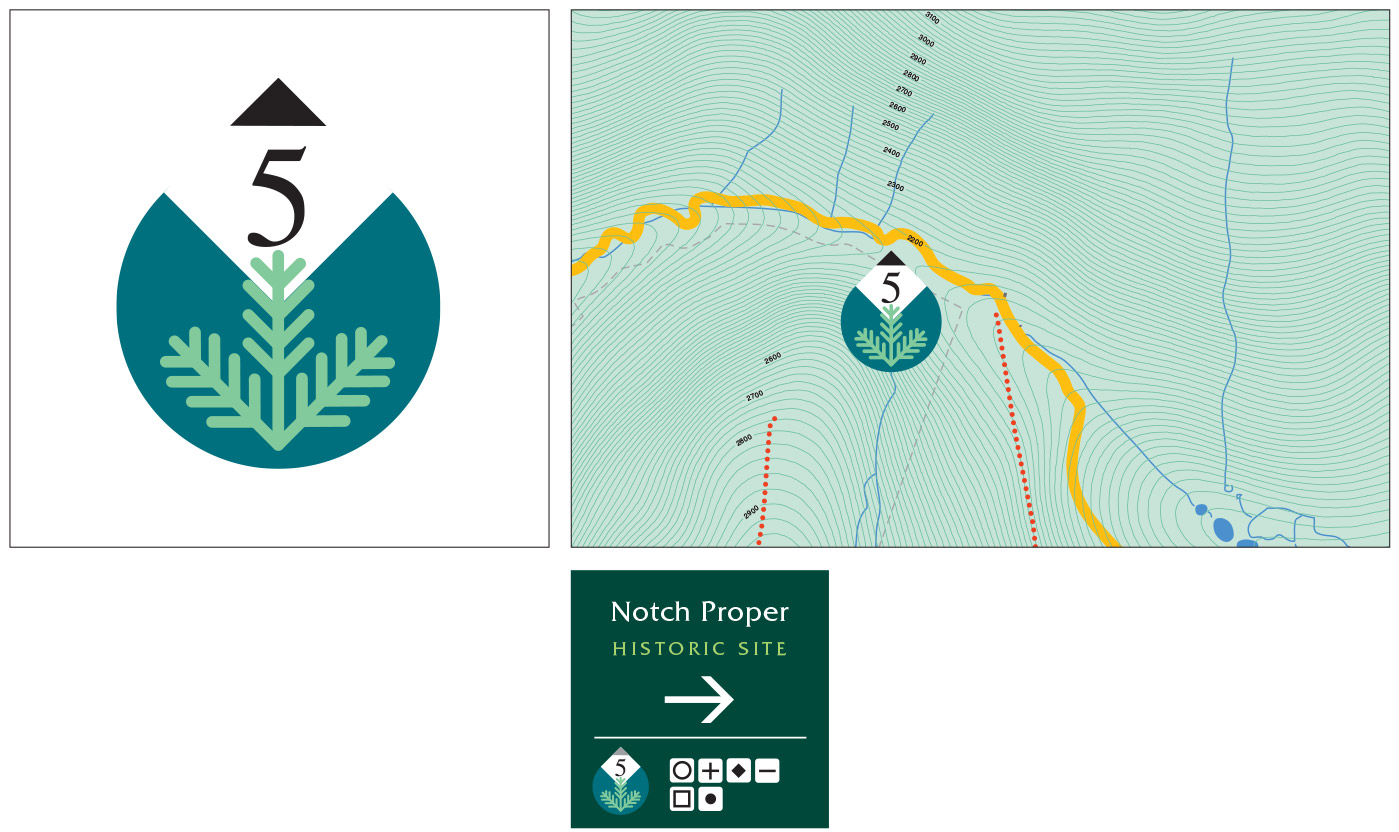
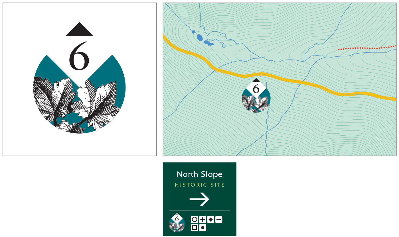
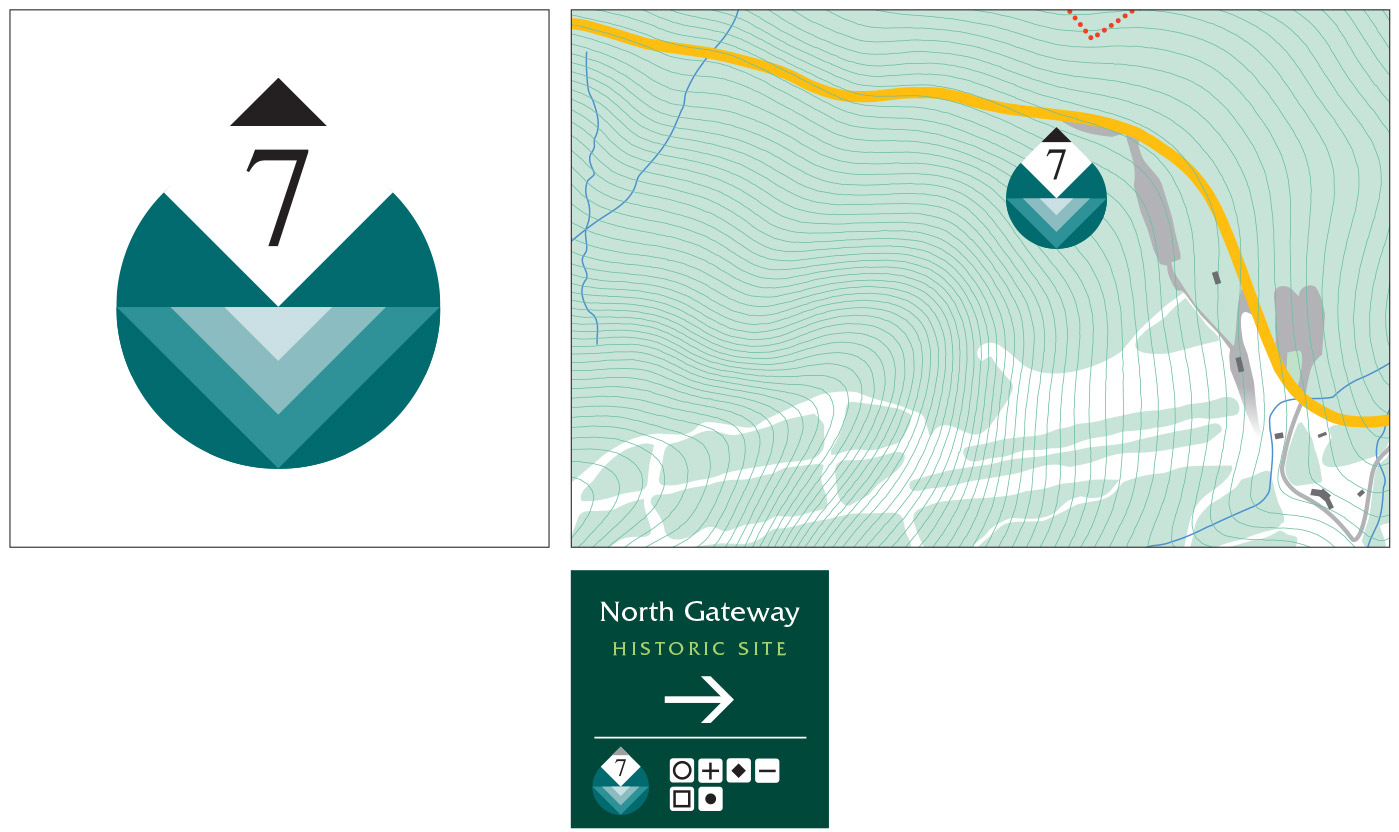
The map is linked to the point-of-arrival signs at a series of recreational stops by a system of identity icons. Numerals and symbols are used to represent the natural, historical, and recreational amenities available for visitors along the length of the Highway. For example, a visitor wishing to find the “Big Spring” first locates icon 4 with its site description on the map, and then looks for the matching icon and title at the appropriate stop along the Highway.
In icons 1 and 7, the Notch itself is suggested in a series of v-angles while the checkered tablecloth symbolizes the Picnic Area in icon 2. Icons 3, 5, and 6 feature motifs representing wildlife and vegetation typically found at those sites.
When the project is completed, the map will be displayed in the information kiosks and will also be available as a hand-out.